|
[Friday] October 19th we left Richmond about 10:30 AM after stopping at Kroger to get last minute items and fill the truck. We went up TX-99 to IH-10, then Beltway 8 to I-45 north. We exited at Huntsville and went north on TX-19 and TX-155 to Tyler State Park for our first night stop. We arrived about 5:15 PM. Our assigned camp spot was #73.
 < Our campsite at Tyler State Park. < Our campsite at Tyler State Park.
Click on the small photos to enlarge them.
[Saturday] After breakfast, we decide to hike the trail that goes all around Lake Tyler. It was a nice trail mainly through the woods. We watched a Great Egret have his brunch on the edge of the lake. Fishing was very good for him. We also saw several groups of ducks. The trail length was about 2 - 3 miles.
 < <
 < Lake Tyler from the trail. < Lake Tyler from the trail.
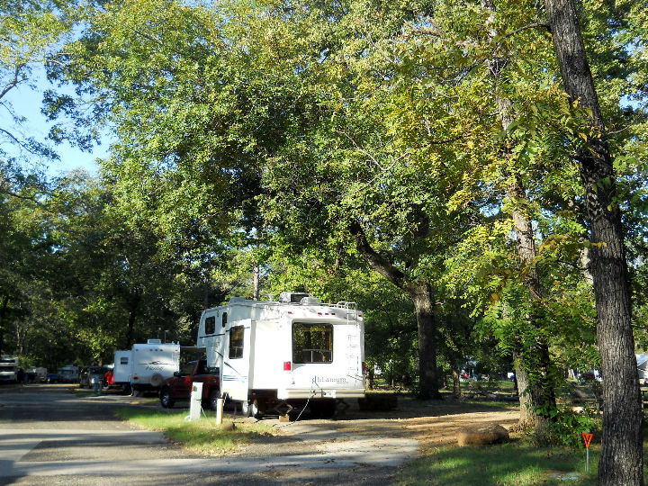
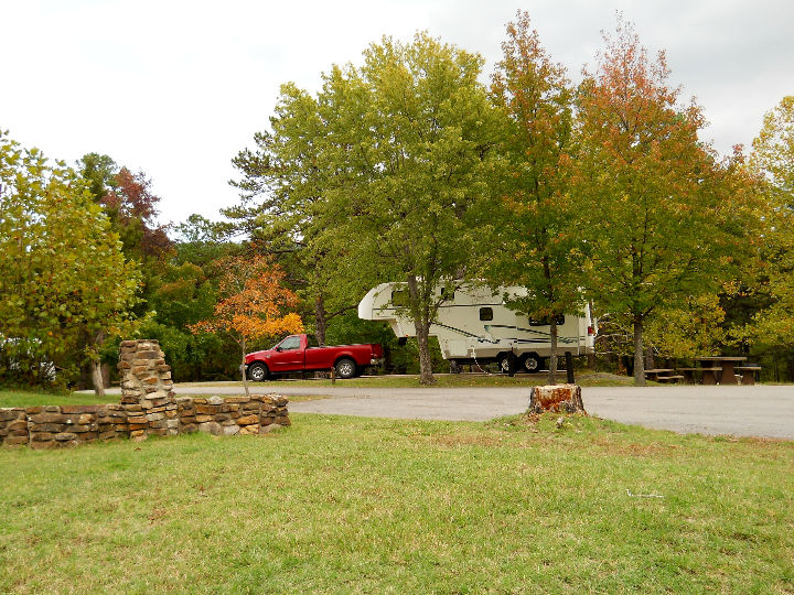
After lunch, we left the park and headed toward Oklahoma, and McGee Creek State Park. On the way we traveled up US-69, TX-37, TX-154, TX-19, US-271 and OK-3. We passed through some very interesting towns that we decided were worth exploring some time when we have the time (Mineola, Sulfur Springs & Paris). We arrived at the park about 4:45 PM and got a really nice site (#7) in the Buster Hights Campground.
 < Our site at McGee Creek State Park. < Our site at McGee Creek State Park.
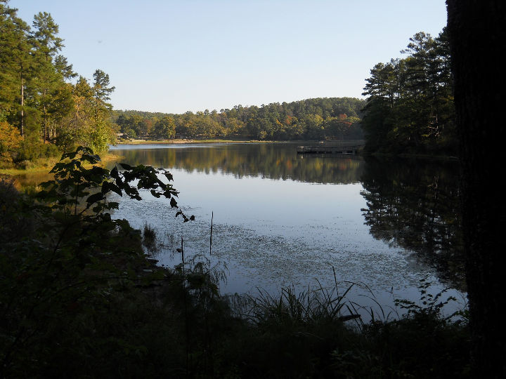
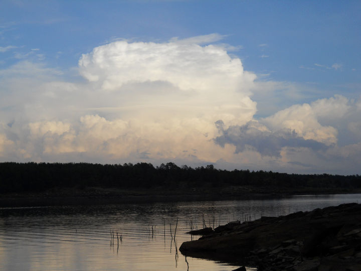
[Sunday] In the morning we walked around and explored the Buster Hights Campground. We walked through the camping loop and down to the lake fishing pier. The weather was heavy overcast with a stiff south wind. As we arrived at the lake, we saw a lone Bald Eagle flying down the lake. His great size and white head were unmistakable. We will be looking out for more as we stay here. We returned to the trailer by 9:30, in time to hear the Second Baptist Church service on KHCP in Paris. After lunch we drove over to the Potapo Campground to hike the 1.4-mile Patapo Hiking Trail. It winds through the pine woods down a hill to the lake, then back up to the start. By then the clouds had thinned and it was a little too warm to suit us - about 83 degrees - so we will do most of our hiking in the early morning unless it cools off more. After the hike, we rode around the campground and through some of the rest of the park, then back home.
 < McGee Creek Reservoir. < McGee Creek Reservoir.
 < On Potapo Trail. < On Potapo Trail.
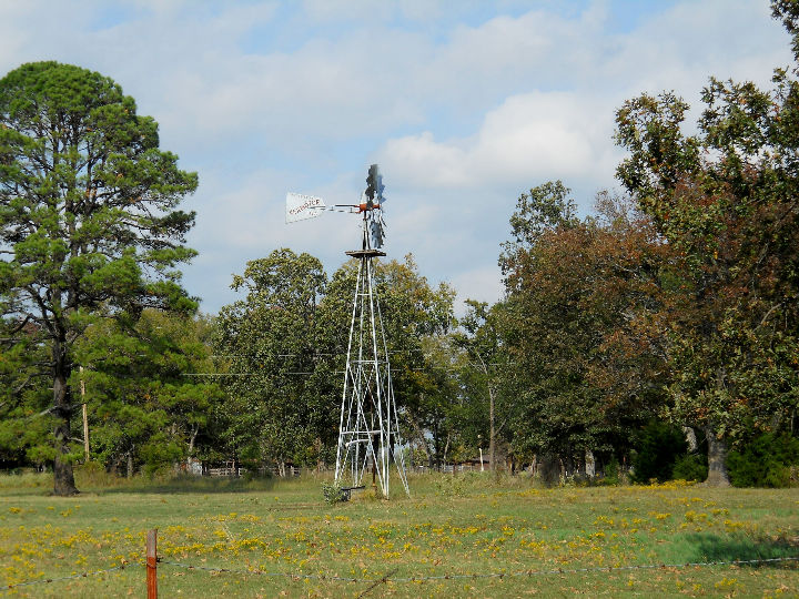 < Working windmill outside the park. < Working windmill outside the park.
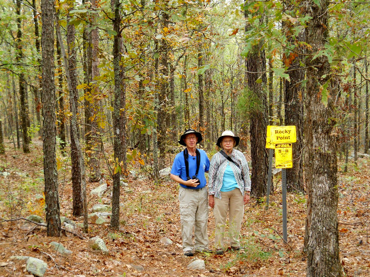
[Monday] In the morning we drove about 15 miles to the McGee Creek Natural Scenic Recreation Area to hike on some of their trails. The first trail we took was the Carnasaw Nature Trail. At its junction with the Rocky Point Trail, we took Rocky Point until it intersected the West Branch trail. We covered about 2 miles on good trails, but on some steep inclines. Rocks of all sizes and shapes cover this part of Oklahoma. After returning to the trailer for lunch, we stayed around the trailer in the afternoon for a rainstorm to pass through. Late in the afternoon, we walked along the lake and saw a Kingfisher.
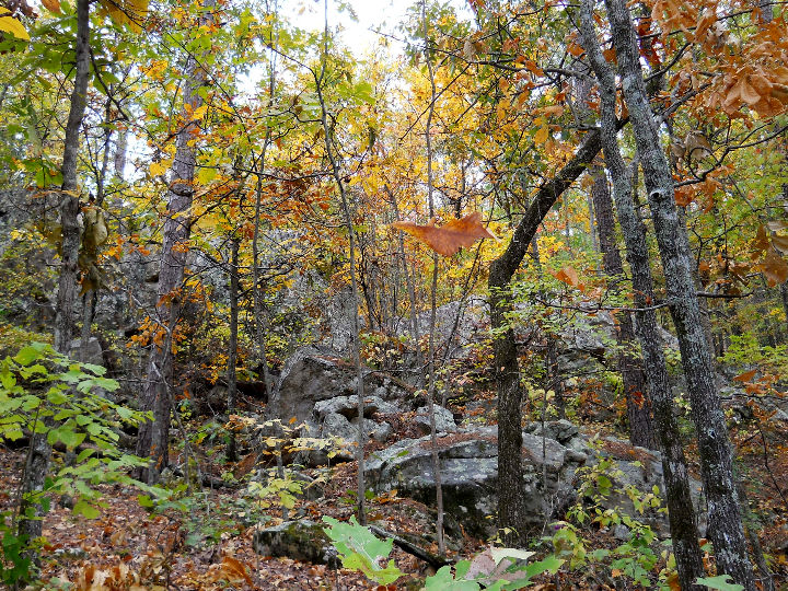 < Some fall colors in the rocks. < Some fall colors in the rocks.
 < Along the trails. < Along the trails.
 < After the rain. < After the rain.
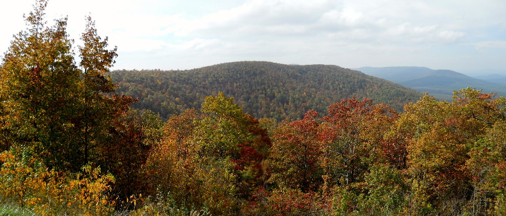
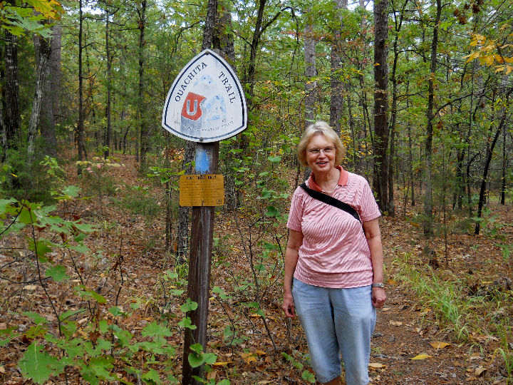
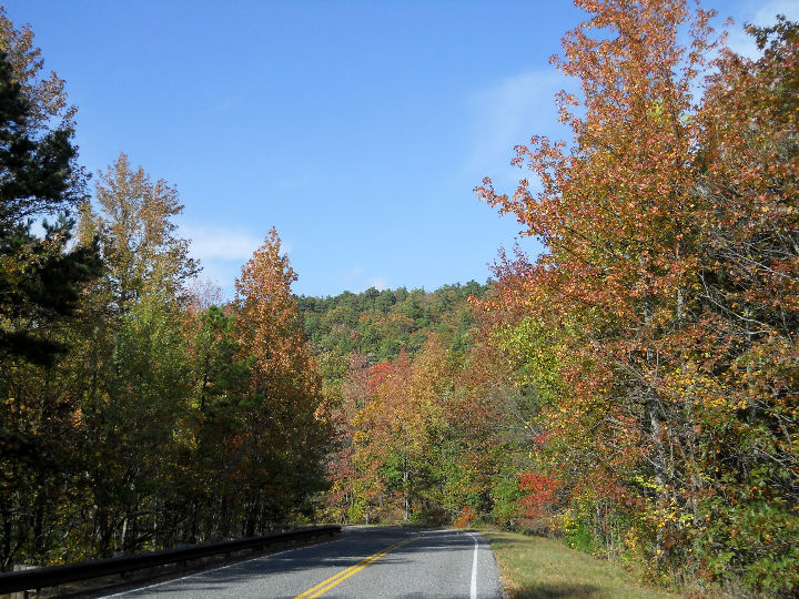
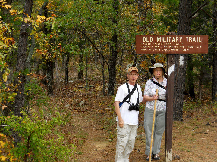
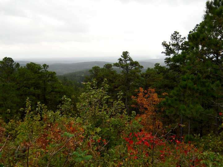
[Tuesday] Today, we leave McGee Creek State Park and move further into Oklahoma to Talimena State Park. We traveled east on OK-3 to Antlers, where after a brief stop at the grocery, we drove up OK-2 to Clayton. That is a beautiful drive in the valley of the Kiamichi Mountains, following the Kiamichi River. There was quite a bit of Fall colors in the mountains, but it was overcast all day and quite blustery wind, so the colors didn't stand out like they would if the sun were shinning brightly. At Clayton we joined US-271 to Talihina and on to the park. We were placed in site #9. This is a very small campground and reservations are required. It is adjacent to the Talimena National Scenic Byway.
By mid-afternoon we were ready to do a little exploring so we hiked along the Ouachita Trail to where it intersects the Old Military Road Trail - about 1 mile in the wooded hills. We then turned around and hiked the mile back to the camp. Good exercise in the steep hills.
 < Our site #9. < Our site #9.
 < Starting out on the Ouachita Trail. < Starting out on the Ouachita Trail.
[Wednesday] In the morning we drove the short distance to the start of the Talimena National Scenic Byway and headed east on it. We stopped at the parking for the Old Military Road Trail. We hiked on the trail that connects to the Ouachita Trail we walked yesterday. It was 1 mile of steep mountainside trail to get to that place. After returning to the truck, we continued east on the Byway. We exited the Byway at US-259 and took the low road into Mena, AR. We ate a late lunch at the Chopping Block Restaurant, which is housed in a log cabin. After lunch, we drove back to Talimena State Park on the Byway, stopping along the way to view the scenery. Unfortunately, the Fall colors peaked about 2 weeks earlier on the top of the mountain, so they weren't as outstanding as they could have been. Also, the haze and humidity made the mountains all have a smoky appearance that obstructed the great view. Anyhow, you take what you get and are grateful.
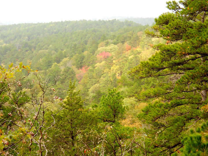 < <
 < View from the trail. < View from the trail.
 < <
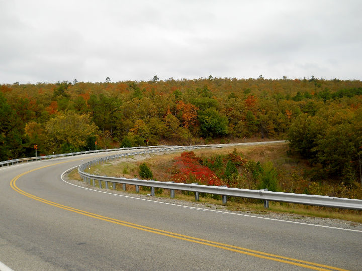
 < Along Talimena National Scenic Byway. < Along Talimena National Scenic Byway.
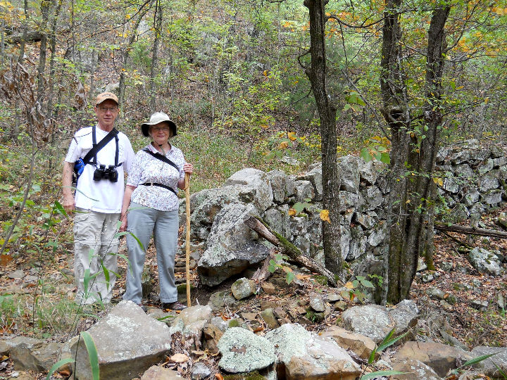
[Thursday] Today a cold front is supposed to come through and end our summer weather for this trip. So far, it has been in the 70's or lower 80's in the day and 50's or 60's at night. Excellent camping weather! After the front comes through it is to be in the 30's & 40's at night and in the 50's & 60's in the day. In the morning we drove over to the Scenic Byway and hiked the Old Military Road Trail for about 1 mile down the mountain, then back. The road was constructed in 1832 by "pick and shovel" solders using hand tools and mule-drawn scrapers to carve the 150-mile route over Winding Star Mountain. The ground is completely covered with rocks of every size imaginable. During our hike it looked like rain and the wind was blowing strong out of the south. When we returned back to the truck after the hike, it was starting to mist lightly. We drove back to the trailer and ate lunch. After lunch, after looking at the weather radar on Kay's iPhone, we decided that we might be able to hike down the ORV Trail that leads from the park before the rain arrived. Just as we were about to walk out of the trailer, it began to rain. Hike canceled! We spent the rest of the day at the trailer. It rained off and on and the cold front whisked through and dropped the temperature from 70 to 50 in about one hour.
 < <
 < Old Military Road Trail. < Old Military Road Trail.
 < View from Talimena National Scenic Byway. < View from Talimena National Scenic Byway.
[Friday] We woke up to 41 degrees outside, a clear sky and a brisk north wind. We moved the trailer from Talimena State Park onto OK-1 south, then OK-2 north to Robbers Cave State Park. We were placed in site #6 in the Whispering Pines Campground. After lunch, we walked up to the Belle Starr Lodge, then back down the Coon Ridge Trail back to the campground. Then we drove throughout the park and examined it all. This is an extremely large park with lots of campgrounds, cabins, equestrian campground, and the lodge. We drove over to the Robbers Cave, but since it was getting late in the day, we didn't walk up the trail that climbs up to the cave.
 < Our site #6. < Our site #6.
 < OK-2 north of Wilburton. < OK-2 north of Wilburton.
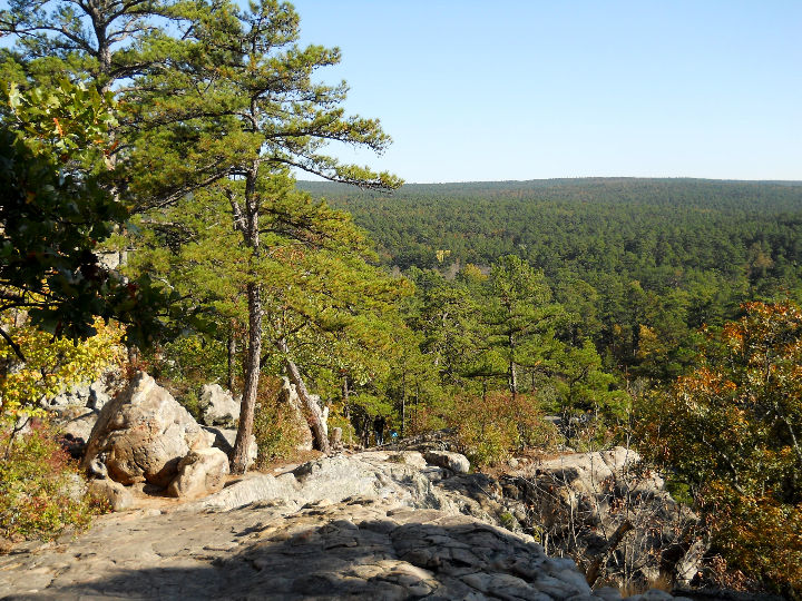
 < View from Belle Starr Lodge. < View from Belle Starr Lodge.
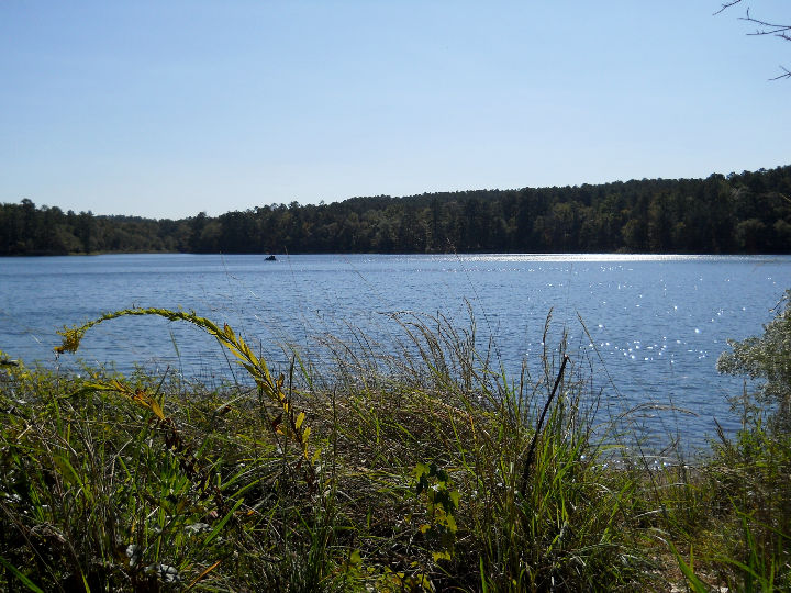
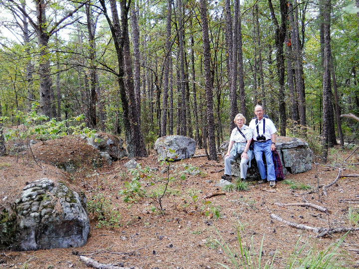
[Saturday] We drove to Lake Carlton and hiked along the Outdoor Classroom Trail. It was sunny but cold (in the 40's) and we saw lots of birds in the trees along the trail. There was a beautiful view of the lake and the mountainside on the other side of the lake. We returned back to the trailer for lunch, then we drove to Robbers Cave and met the Park Naturalist at 3 PM for a guided tour of the cave. It was a very interesting 2-hour walk up to the cave and back through the large rocks. He showed us many plants and animals and some of the history that we would have missed if we had taken it on our on. Afterwards we returned to the trailer to complete a nice day in the woods.
 < <
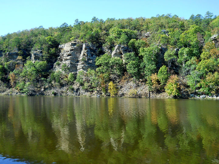 < Lake Carlton. < Lake Carlton.
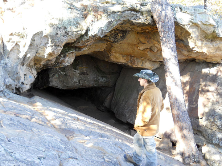 < Our guide at the entrance to Robbers Cave. < Our guide at the entrance to Robbers Cave.
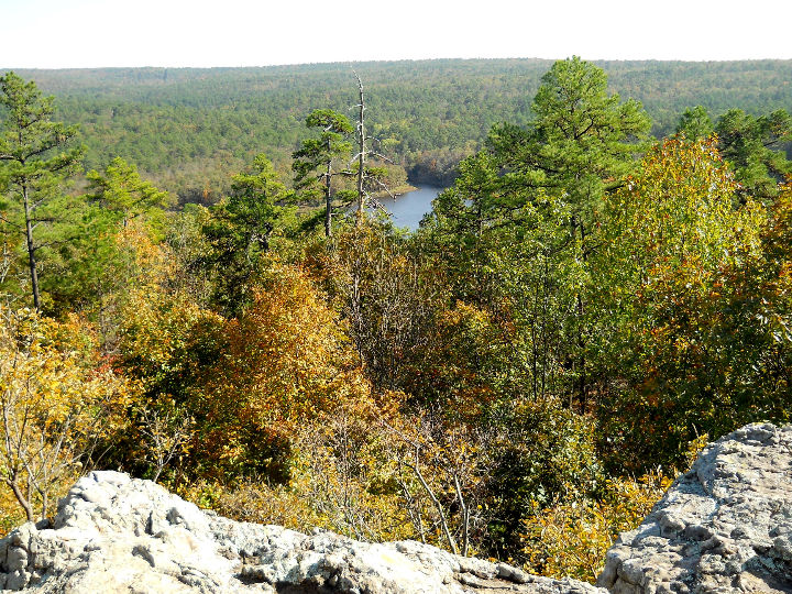
 < View from Robbers Cave. < View from Robbers Cave.
 < Here we are at the top. < Here we are at the top.
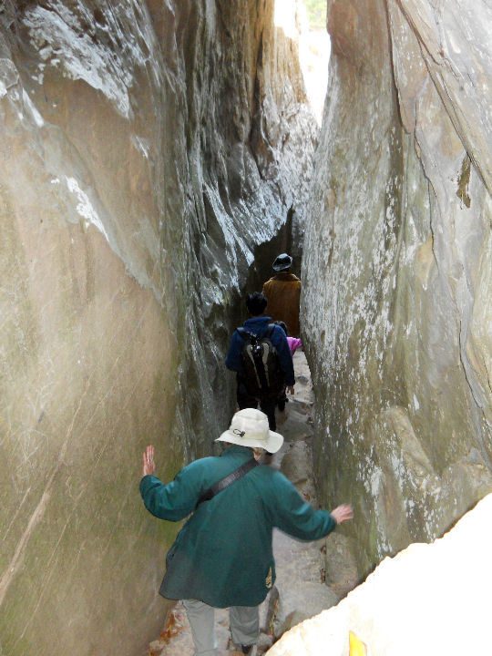 < It got tight in places. < It got tight in places.
[Sunday] It was still clear and cold this morning - about 34 degrees in the campground. After breakfast we left Robbers Cave and traveled south on OK-2, then US-271. We were planning to stop at Clayton Lake State Park, but when we stopped, no one was around to guide us to a site. We sampled a couple of campgrounds but couldn't find anything with water & electric, so we headed south on US-271 to Antlers. At Antlers, we took OK-3, OK-93 and US-70 to Kiamichi Park, adjacent to Hugo Lake State Park. We camped in site R3 of the Raccoon Campground. The park is one of the U.S. Army Engineer Corps lakes. The lake appears to be about 10 feet low, evidently due to the drought for the last 2 years. After we set up camp, we rode around the park to see the other campgrounds. We also took a short hike on one of the equstrinne trails before retiring to the trailer for supper.
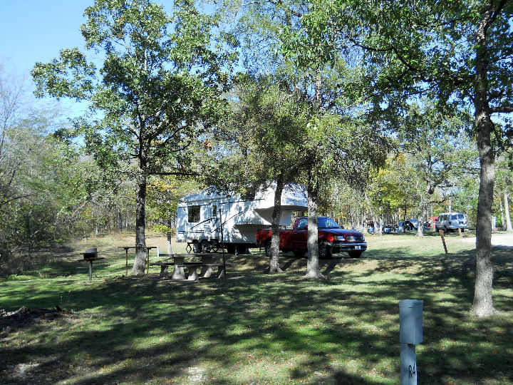 < Site R3. < Site R3.
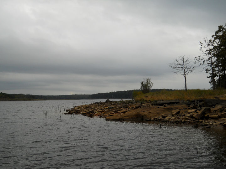
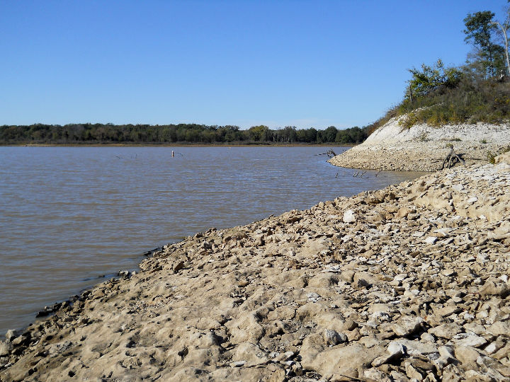 < Hugo Lake is down about 10 feet. < Hugo Lake is down about 10 feet.
[Monday] Today we woke up to the coldest night on our trip - 32 degrees and a clear sunny sky. After breakfast we continued our return south. We took US-70 and US-271 out of Oklahoma and into Texas, and at Paris, we took TX-19 to Canton. We stopped and ate lunch in front of the First Monday building. We continued on TX-19 to Athens, where we took FM-59 south to US-287, then west to FM-488, then south to FM-833, then FM-2570 to Ranch Road 3285 into Fairfield Lake State Park. We were assigned spot #74 in the Cooks Ferry Camping Area. After we connected and got the trailer set, we walked for about 1 hour on the Nature Trail which goes through the woods near the lake. We saw a variety of birds along the way, as well as a few deer.
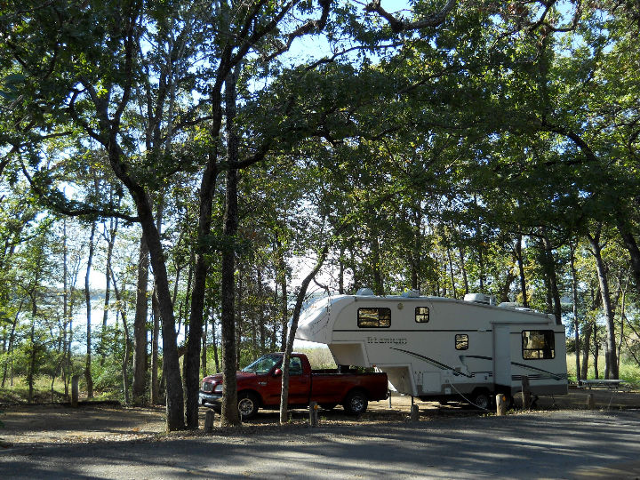 < Our site #74. < Our site #74.
 < View of the lake from the Nature Trail. < View of the lake from the Nature Trail.
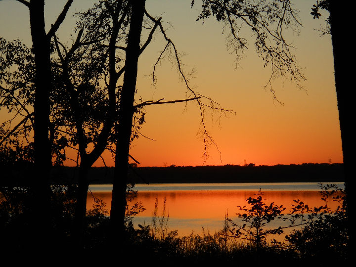 < Nice sunset from our camp site. < Nice sunset from our camp site.
[Tuesday] Today, we have to go back home. After breakfast, we take RR-3285, FM-2570, RR-488 & US-84 to Fairfield. From there we followed IH-45, IH-610, US-59 & ALT-90 back to Richmond, arriving in mid-afternoon.
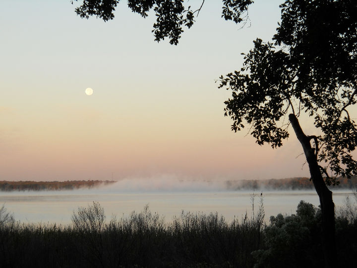 < Morning fog rises on the lake as the moon sets. < Morning fog rises on the lake as the moon sets.
This draws to a close our visit to Southeast Oklahoma. We hope you enjoyed the photos and brief descriptions of our activities. God willing, join us again soon for another RV adventure.
Goodbye for now,
Lawson & Kay
Nov 07, 2012
Remember this, my dear friends! Everyone must be quick to listen, but slow to speak and slow to become angry. Human anger does not achieve God's righteous purpose. (James 1:19-20 GNB)
[Back to Home Page]
|